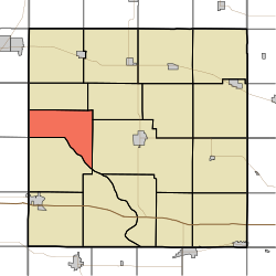
앙금군구(아이오와주 삼나무군)
| 앙금군구, 삼나무군 | |
|---|---|
| — 군구 — | |
| 좌표: 북위 41도 47부 16초 서경 091도 17부 16초□/□북위 41.78778도 서경 91.28778도□/ | |
| 국 | |
| 주 | |
| 군 | 삼나무군 |
| 면적 | |
| - 계 | 26.98mi2 (69.88km2) |
| - 육지 | 26.15mi2 (67.72km2) |
| - 수면 | 0.83mi2 (2.16km2) |
| 표고[1] | 771ft (235m) |
| 인구(2000) | |
| - 계 | 295명 |
| - 인구밀도 | 11.3명/mi□(4.4명/km□) |
| FIPS code | 19-90495[2] |
| GNIS feature ID | 0467539 |
앙금군구는, 아메리카 합중국, 아이오와주, 삼나무군에 있는 17의 군구의 하나이다.2000년의 국세조사로, 인구는 295명이었다.
지리
앙금군구는, 69.9평방 킬로미터(26.98평방 마일)로, 짜넣어진 자치체(incorporated settlements)는 없다. 미국 지질 조사소에 의하면, 이 군구는 Cass와 Evergreen와 Mathews와 Shawver의 4개의 묘원이 포함된다.
참고 문헌
- ^ US Board on Geographic Names, United States Geological Survey, (2007-10-25), 2008년 1월 31일 열람.
- ^ American FactFinder, United States Census Bureau 2008년 1월 31일 열람.
외부 링크
This article is taken from the Japanese Wikipedia 앙금군구(아이오와주 삼나무군)
This article is distributed by cc-by-sa or GFDL license in accordance with the provisions of Wikipedia.
In addition, Tranpedia is simply not responsible for any show is only by translating the writings of foreign licenses that are compatible with CC-BY-SA license information.

0 개의 댓글:
댓글 쓰기