후루이치쵸(마에바시시)
| 후루이치쵸 | |
|---|---|
| — 정정 — | |
| JR동일본 죠에츠선 신마에바시역 | |
| | |
| 좌표: 북위 36도 22부 36초 동경 139도 2부 58초□/□북위 36.37667도 동경 139.04944도□/ | |
| 국 | |
| 도도부현 | |
| 시읍면 | |
| 면적 | |
| - 계 | 0.78km2 (0.3mi2) |
| 인구[1] | |
| - 계 | 2,488명 |
| - 인구밀도 | 3,189.7명/km□(8,261.4명/mi□) |
| 등시대 | JST (UTC+9) |
| 우편번호 | 371-0844 |
| 넘버 플레이트 | 마에바시 |
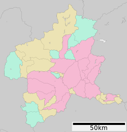
후루이치쵸(후루한거리)는, 군마현 마에바시시의 지명.후루이치쵸와 후루이치쵸 잇쵸메가 있다.우편번호는371-0844[2].2013년 현재의 면적은 0.78 km2[3].
목차
지리
북측으로 죠에츠선이 지나고 있다.
역사
| 이 마디의 가필이 바람직하고 있습니다. |
교육
초등학교는 마에바시시립동 초등학교와 마에바시시원소샤남 초등학교, 중학교는 마에바시시립 히가시나카 학교와 마에바시시립원소샤 중학교의 통학 구역으로 지정되어 있는[4].
교통
시설
출전
- ^ "주민 기본 대장 헤세이 28년 3월 31일 현재". 마에바시시. 2015년 5월 3일 열람.
- ^"후루이치쵸의 우편번호". 일본 우편. 2016년 5월 3일 열람.
- ^제2 아키토구-마에바시시 2016년 05월 03일 열람.
- ^"마에바시시립 초등학교 및 중학교의 통학 구역에 관한 규칙". 마에바시시. 2016년 5월 3일 열람.
This article is taken from the Japanese Wikipedia 후루이치쵸(마에바시시)
This article is distributed by cc-by-sa or GFDL license in accordance with the provisions of Wikipedia.
In addition, Tranpedia is simply not responsible for any show is only by translating the writings of foreign licenses that are compatible with CC-BY-SA license information.


0 개의 댓글:
댓글 쓰기