아르베리(뉴질랜드)
| 아르베리 Albury | |
|---|---|
 아르베리 | |
| 좌표: 남위 44도 13부 50초 동경 170도 52부 26초□/□남위 44.23056도 동경 170.87389도□/ -44. 23056; | |
| 국 | |
| 지방 행정 구분 | 캔터베리 지방 |
| 등시대 | NZST (UTC+12) |
| - 서머타임 | NZDT (UTC+13) |
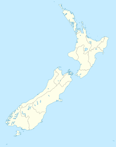
아르베리(영: Albury)는, 뉴질랜드의 남도의 캔터베리 지방 남부에 있는 작은 마을.티마르로부터 내륙에 위치해, 프레잔트・포인트와 페어리의 사이, 스테이트 하이웨이 8에 있다.
아르베리는, 지방의 농업 지대에 있어, 19 세기의 6년 이상의 사이, 페어리 지선(Fairlie Branch)이 되는 지선 철도 노선의 임시의 종착역을 근무하고 있었다.선로는 1877년 1월 1일에 개통해, 마을을 넘어 Winscombe까지의 연장이 1883년 8월 24일에 개통한[1][2].페어리 지선은, 1968년 3월 2일에 폐쇄되었지만, 선로의 얼마인가의 구성은, 아직 아르베리 주변에서 볼 수 있다.[3]
각주
- ^ New Zealand Railway and Tramway Atlas, fourth edition, edited by John Yonge (Essex: Quail Map Company, 1993), 24.
- ^ New Zealand Railways Department, Geographical Mileage Table (New Zealand Railways Department: Place of publication within New Zealand unknown, 1957), 19.
- ^ David Leitch and Brian Scott, Exploring New Zealand's Ghost Railways, revised edition (Wellington: Grantham House, 1998 [1995]), 79-80.
외부 링크
- "Albury School"(영어). 2013년 12월 14일 열람.
- "Mackenzie District Council"(영어). 2013년 12월 14일 열람.
좌표: 남위 44도 13부 50초 동경 170도 52부 26초□/□남위 44.23056도 동경 170.87389도□/ -44. 23056;
This article is taken from the Japanese Wikipedia 아르베리(뉴질랜드)
This article is distributed by cc-by-sa or GFDL license in accordance with the provisions of Wikipedia.
In addition, Tranpedia is simply not responsible for any show is only by translating the writings of foreign licenses that are compatible with CC-BY-SA license information.
0 개의 댓글:
댓글 쓰기