르・탄풀=슈르=로트
| Le Temple-sur-Lot | |
|---|---|
  | |
| 행정 | |
| 국 | |
| 지역권(Region) | Aquitaine 지역권 |
| 현(departement) | 로트=에=가론누현 |
| 군(arrondissement) | 비르누브=슈르=로트군 |
| 오구니(canton) | 리브라데 오구니 |
| INSEE 코드 | 47306 |
| 우편번호 | 47110 |
| 시장(임기) | 다니엘・베크레이르 (2014년-2020년) |
| 자치체간 연합(fr) | fr:Communautede communes Lot et Tolzac |
| 인구 동태 | |
| 인구 | 997명 (2012년) |
| 인구밀도 | 59명/km□ |
| 지리 | |
| 좌표 | 북위 44도 22부 50초 동경 0도 31부 32초□/□북위 44.3805555556도 동경 0.525555555556도□/ 좌표: 북위 44도 22부 50초 동경 0도 31부 32초□/□북위 44.3805555556도 동경 0.525555555556도□/ |
| 표고 | 평균:41 m 최저:32 m 최고:190 m |
| 면적 | 16.91 km□ |
 Le Temple-sur-Lot | |
| 공식 사이트 | Site de la mairie |
르・탄풀=슈르=로트(Le Temple-sur-Lot)는, 프랑스, Aquitaine 지역권, 로트=에=가론누현의 컴뮨.
목차
지리
컴뮨은 비르누브=슈르=로트 도시권에 포함되어 비르누브와 트난의 사이, 로트 강가에 있다.
역사
한 때의 템플 기사단의 커멘드 리는 13 세기에 건설되었다.
현재의 컴뮨은, 1806년부터 이전에 산・쟌・데이르 및 산・슈르피스・드・리베르와 1839년에는 카프라지 및 산・제르베와 합병해 확대한 것이다.산・제르베는, 프랑스 혁명 후의 국민공회 시대(1792년부터 1795년)에는 라・후라테르니테(La Fraternite)와 개명되고 있던[1].
인구통계
| 1962년 | 1968년 | 1975년 | 1982년 | 1990년 | 1999년 | 2006년 | 2012년 |
|---|---|---|---|---|---|---|---|
| 927 | 954 | 898 | 902 | 933 | 969 | 991 | 997 |
볼거리
-

싶은 연못
-
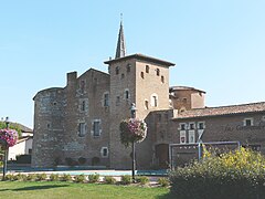
커멘드 리
각주
- ^ Des villages de Cassini aux communes d'aujourd'hui,□Notice communale de Saint-Gervais□, sur EHESS, Ecole des hautesetudes en sciences sociales (consultele 6 juillet 2012).
- ^ http://cassini.ehess.fr/cassini/fr/html/fiche.php?select_resultat=37204
- ^ http://www.statistiques-locales.insee.fr
- ^ http://www.insee.fr
This article is taken from the Japanese Wikipedia 르・탄풀=슈르=로트
This article is distributed by cc-by-sa or GFDL license in accordance with the provisions of Wikipedia.
In addition, Tranpedia is simply not responsible for any show is only by translating the writings of foreign licenses that are compatible with CC-BY-SA license information.
0 개의 댓글:
댓글 쓰기