라스 인섬
| 라스 인섬 | |
|---|---|
 남단 | |
| 좌표 | 북위 55도 17부서경 06도 11부□/□북위 55.283도 서경 6.183도□/ |
| 면적 | 12.65 km□ |
| 최고 표고 | 418 m |
| 소재 해역 | 아일리쉬해 |
| 소속국・지역 | |
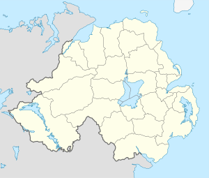
라스 인섬(Rathlin, 아일랜드어:Reachlainn, 스코틀랜드・게르어:Reachra)은, 북 아일랜드의 섬.안트림군에 속한다.본토로부터 6 km 떨어져 있다.대안의 스코틀랜드, 말・오브・킨타이아로부터 25 km 밖에 떨어지지 않았다.L자형의 섬에서, 동서로 7 km, 남북으로 4 km의 길이가 있다.페리가 본토의 배리 캐슬과 왕복한다.인구 75명.
중세의 연대기 안나르즈・오브・알 스타(en)에 의하면, 라스 인섬은 아일랜드섬에서 처음으로 바이킹의 약탈을 당한 땅이다.795년, 바이킹은 섬의 교회를 약탈해, 건물에 불을 질렀다고 한다.
1575년, 악명 높은 학살 사건이 일어났다.초대 에섹스백월터・데브르는 아일랜드 공략을 명하고 생명을 받은 프랜시스・드레이크와 존・노리즈가 섬에 상륙했다.잉글랜드군은, 맥도날드 씨족이 피난하고 있던 섬을 덮쳐, 수백명의 여성과 아이를 살해했다.
현재, 라스 인섬은 당일치기 여행의 관광지로서 인기가 있다.마이크로버스・투어나, 대여 자전거도 있다.섬주위의 난파선을 둘러싼 스쿠버 다이빙도 할 수 있다.
라스 인섬의 아일랜드어 방언은 현재 끊어져 버렸지만, 이전에는, 아일랜드의 어디보다 스코틀랜드・게르어에 가깝다고 여겨지고 있었다.
외부 링크
- Antrim.net's page on Rathlin
- The Northern Ireland Guide: Check Out Our information on Rathlin Island and many other attractions
- The RSPB's Rathlin Cliffs nature reserve
- The Northern Ireland Guide: For information on and pictures of Rathlin Island
- Basic information about Rathlin
- [http://www.libraryireland.com/sketches/rathlin.php Sketches of Olden Days in Northern Ireland
- North Coast Cottages Accommodation
- Photograph of Rathlin
- Landscapes Unlocked - Aerial footage from the BBC Sky High series explaining the physical, social and economic geography of Northern Ireland.
This article is taken from the Japanese Wikipedia 라스 인섬
This article is distributed by cc-by-sa or GFDL license in accordance with the provisions of Wikipedia.
In addition, Tranpedia is simply not responsible for any show is only by translating the writings of foreign licenses that are compatible with CC-BY-SA license information.


0 개의 댓글:
댓글 쓰기